Lamson Woods/Neff Wetlands segment of the Fairfield Loop Trail
Scroll down to view the map.
Lamson Woods/Neff Wetlands segment (Segment # 9)
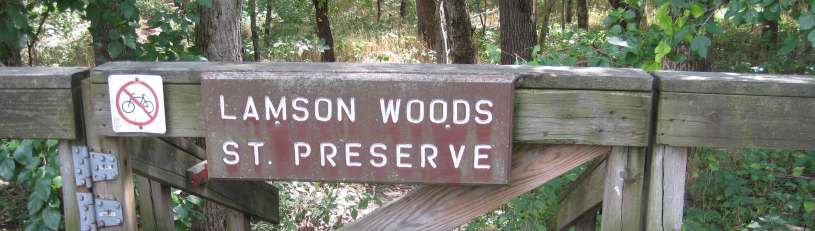
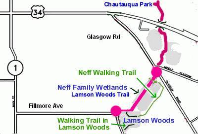
The Lamson Woods/Neff Wetlands section of the Loop Trail begins at Glasgow Road and heads west across the wetlands dike. The Lamson Woods boardwalk/bridge takes you to the Mint Blvd parking lot. A walking-only trail is accessed from the boardwalk. Lamson Woods is a State Preserve (scroll down for details).
Facts about the Lamson Woods/Neff segment of the Loop Trail: See photos of the Lamson Woods/Neff segment.
See the kiosk describing the Iowa DOT wetlands restoration project.
Length= 0.4 miles
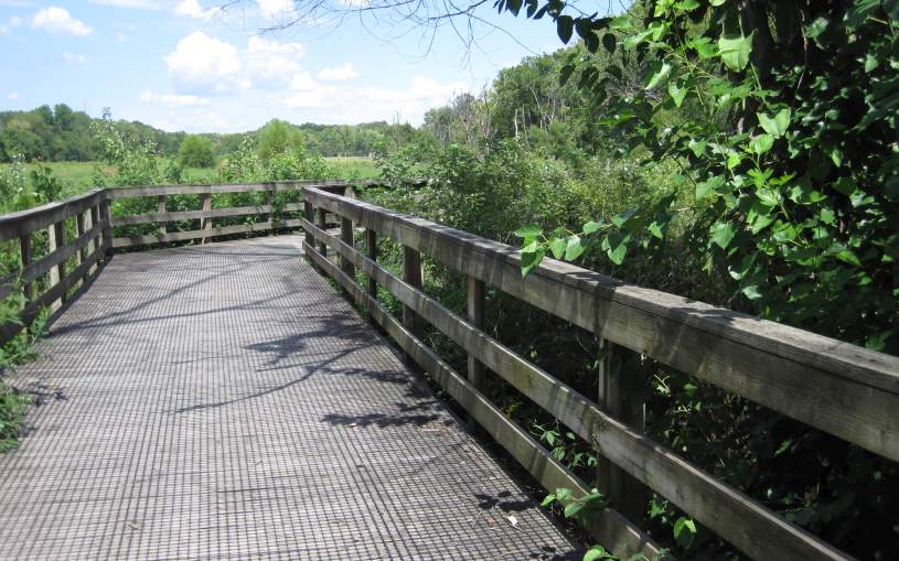
Surface= The 326-foot Zillman Bridge/boardwalk has a wooden deck. The rest is crushed limestone.
East Entry= on Glasgow Rd, 0.6 miles south of Hwy 34, at Middle Glasgow Rd (connects to Crow Creek segment).
West Entry= Intersection of E. Fillmore Ave and Mint Blvd (connects to Mint Blvd Link).
Restroom: At Lamson Woods parking lot, off Mint Blvd.
Parking at the Lamson Woods parking lot, off Mint Blvd and E. Fillmore Ave.
Below: Mile 13 on the Loop Trail through the Neff Wetlands.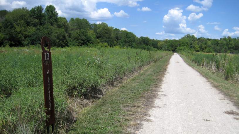
Below: East entrance onto the Neff Wetlands trail. See photos of the bridge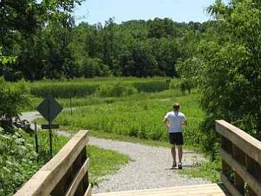 .
.
Below: Looking from the Mint Blvd parking lot to the West entrance onto the Lamson Woods Trail.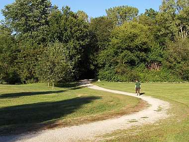
Walking Trails: The walking-only trails are for walking only. The trail in Lamson Woods is in a State Preserve - please obey all of the rules.
The Neff Walking Trail loops from the Loop Trail to the Lamson Woods Walking Trail.
Walking-Only trails map:
About Lamson Woods State Preserve
Text from the kiosk - see Lamson Woods kiosk here.
Lamson Woods is a 43-acre woodland preserve located on the southeast edge of Fairfield. This hilly, wooded area was willed to the city of Fairfield by Carrie Lamson Ross in 18930. Originally "Lamson's Pasture" was a park that included Fairfield's first golf course. The golf course was in a pasture for cows and pigs along a small woodland, and was dubbed "cow-pasture golf". It was a favorite area for hiking and nature study for people of all ages. The woodland was dedicated as a biological state preserve in 1978.
The preserve is a mixture of upland and lowland forest. Mesic and dry woodland species occupy the slope and ravines that are cut into Pre-Illinoian glacial deposits (500,000 to 2.5 million years old) typical of the Southern Iowa Drift Plain landform region. Trees occupying the canopy include cottonwood, white oak, bur oak, shingle oak, shagbark hickory, American elm, hackberry, and black cherry. Ohio buckeye can be found in the understory with hazelnut along the woodland edges. A planted pine grove is located in the southwest corner of the preserve.
The spring wildflower display begins with the blooming of bloodroot, bluebells, and spring beauty, followed by prairie trillium, tooth wort, white trout-lily, blue phlox, wild geranium, mayapple, Solomon's seal, swamp buttercup, and wild hyacinth. By May, moonseed and Jacob's ladder can be seen in flower followed by jumpseed and pale touch-me-not in July. August brings the blooming of hog peanut among the sensitive dren and maidenhair fern fronds. In the fall, the bright red leaves of Virginia creeper can be seen crawling up the trunks of trees or along the ground.
(From The Guide to Iowa's State Preserves).
To learn more about the Iowa DNR State Preserves program, go to the Iowa DNR website.