Aerial views of the Fairfield Loop Trail
Most humans are used to seeing the earth's landscape from a "birds eye" view, looking from a mountain top, tall building, or from a small plane. (Satellite photos are just highly-detailed maps). Scroll down to see photos taken by Stephen Pedrick from a low-flying small airplane in June 2015.
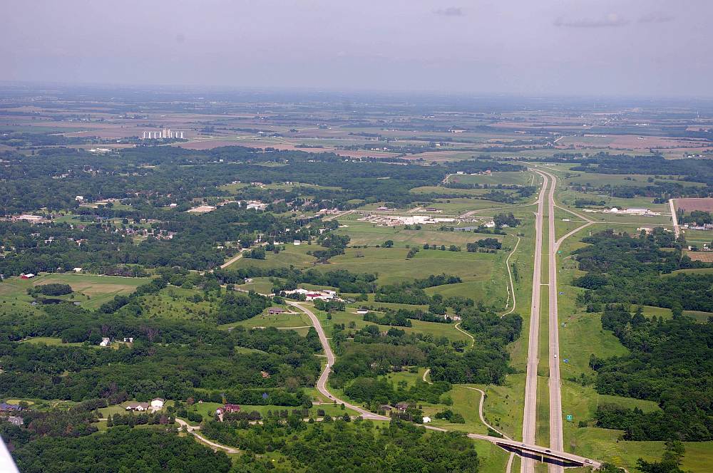
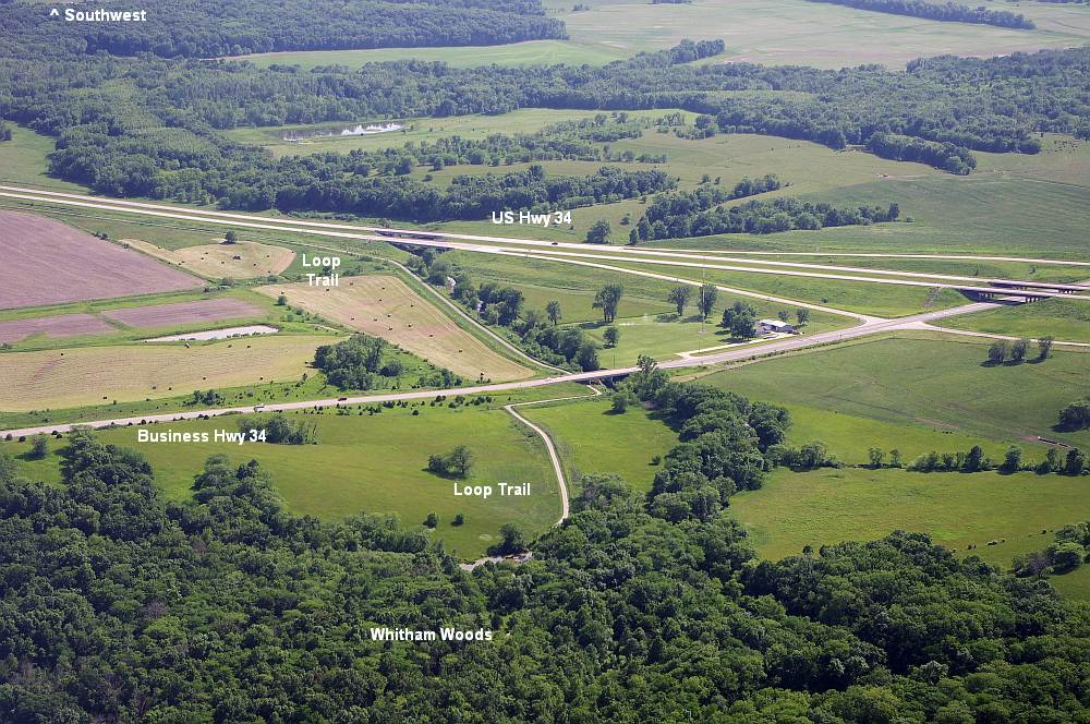
Looking to the east. The South-DOT segment of the Loop Trail is along the highway - see captions on the next photo.
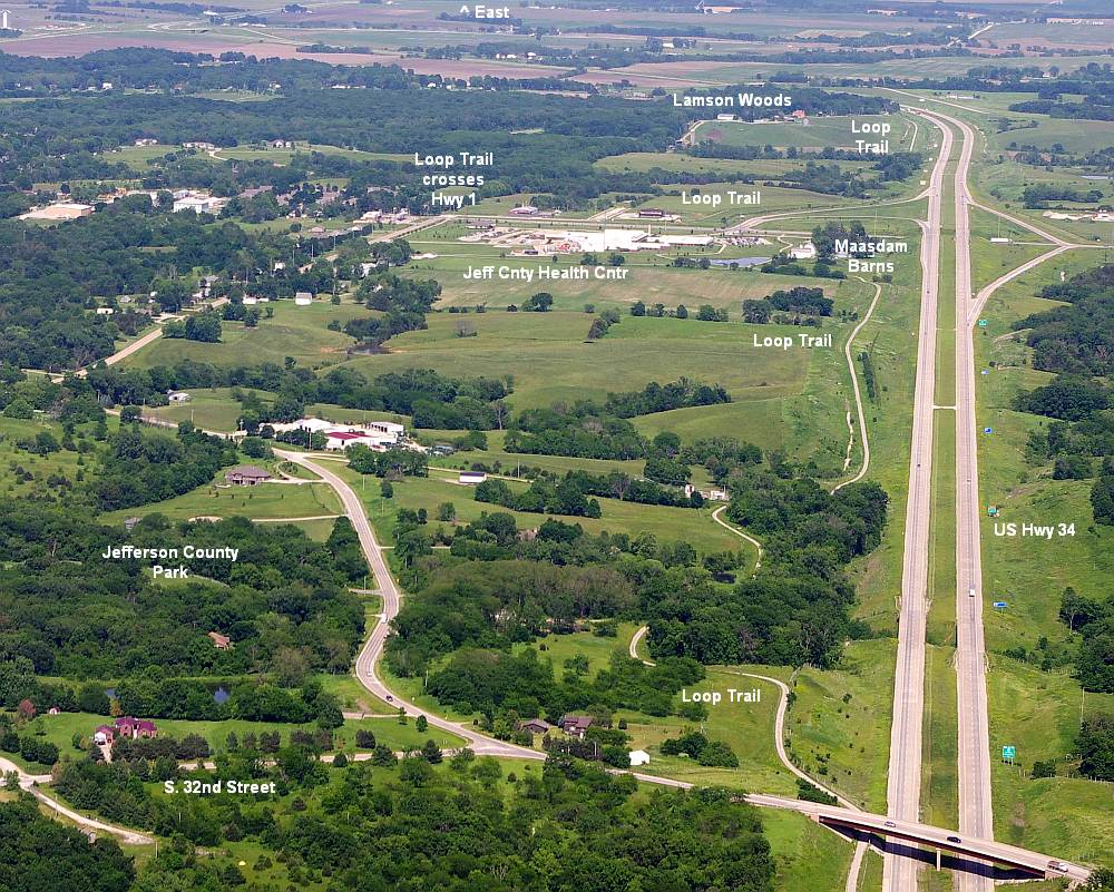
Looking to the east - same view as above. The Loop Trail is to the left of the highway 34.
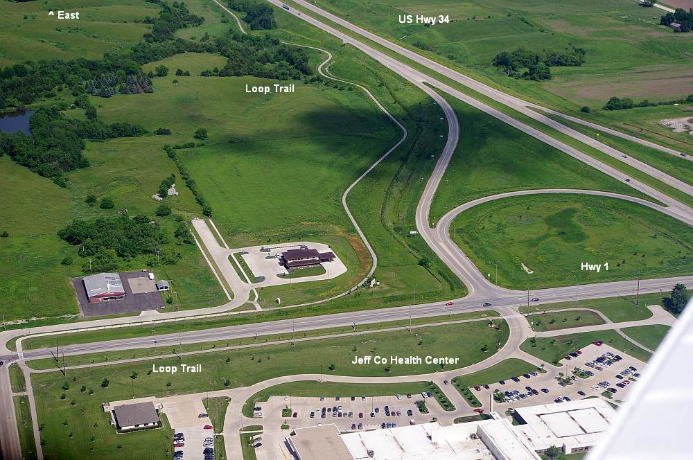
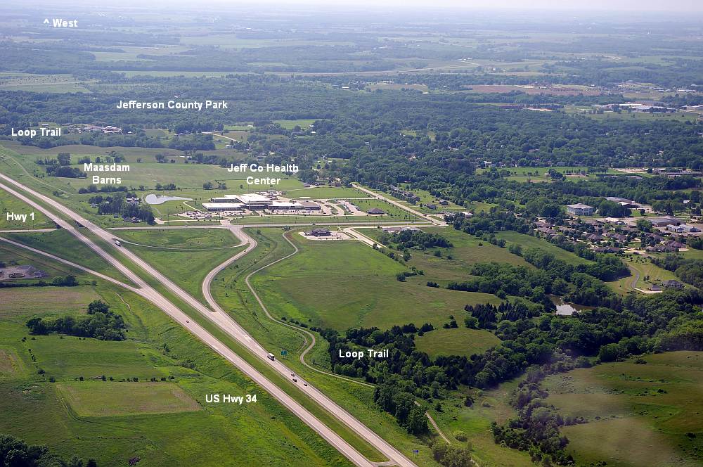
Looking to the east - intersection of Hwy 1 and Hwy 34.
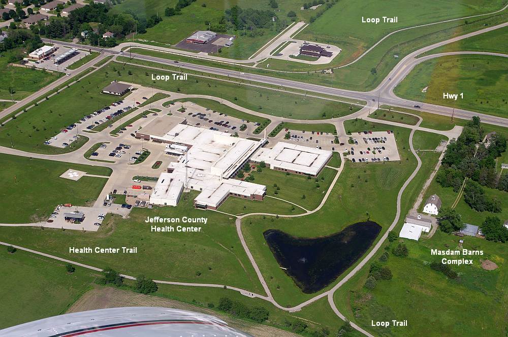
Sightly different angle, showing the Jefferson County Health Center.
Looking to the west, from the same location as above (intersection of Highways 1 and US 34).
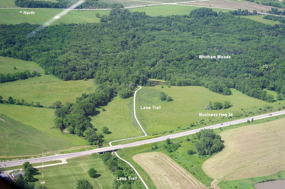
Looking south from Whitham Woods, where the DOT-South segment meets the Whitham Woods segment.
Looking north towards Whitham Woods. (Whitham Woods segment of the Loop Trail)
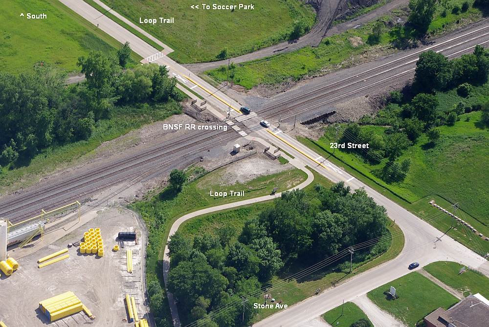
Loop Trail crossing the BNSF Railroad tracks at 23rd Street, on the Northwest segment of the Loop Trail.
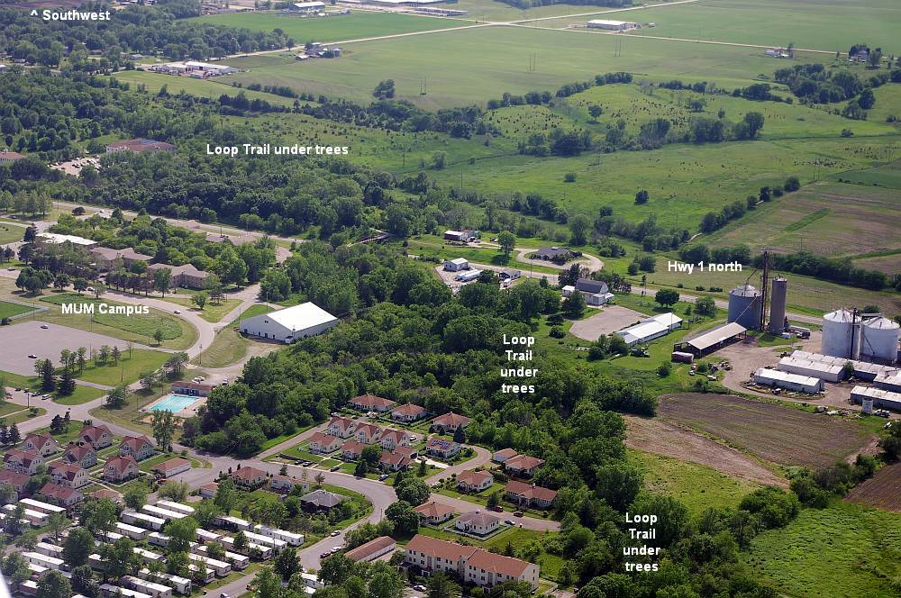
Looking west from MUM campus. The Rock Island Railroad segment of the Loop trail is under the trees.
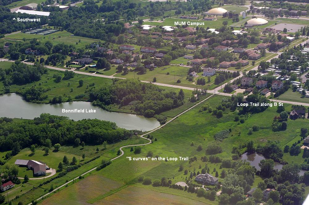
"S curves" next to Bonnifield Lake left on the Lakes segment of the Loop Trail. MUM at top of photo.
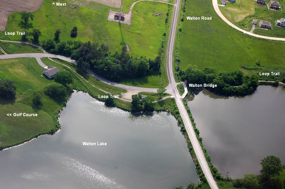
Walton Lake at Walton Road, where the Lakes segment and the Louden segment meet.
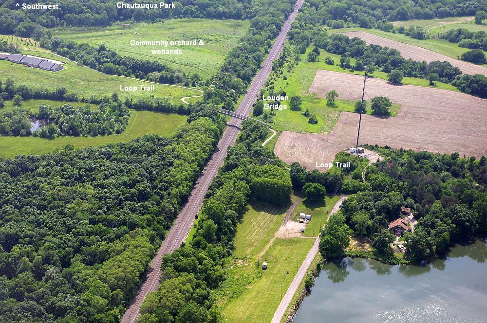
Louden Bridge crossing over BNSF Railroad on the Louden segment of the Loop Trail.
Photos supplied by Stephen Pedrick, June 2015.