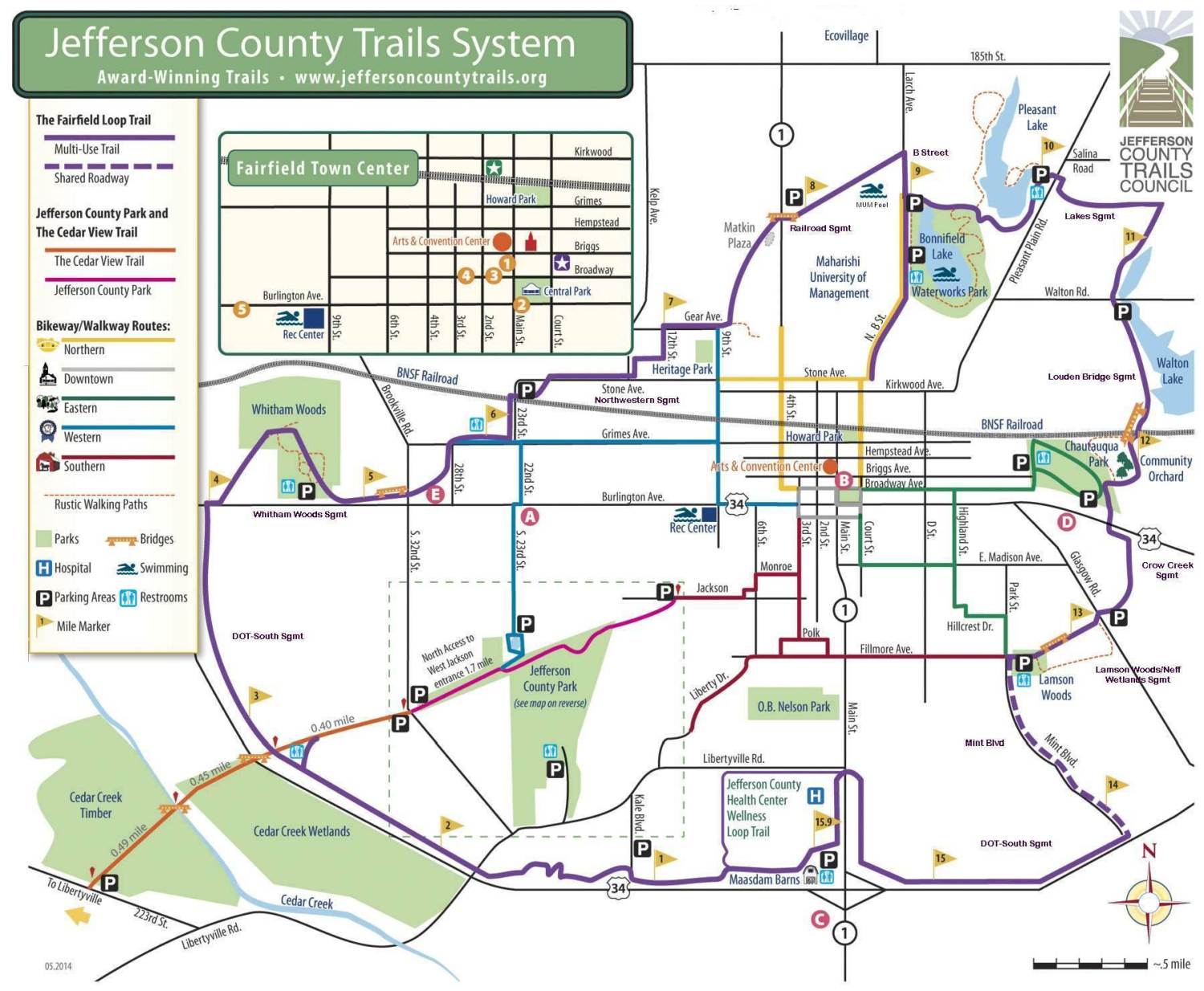
Iowa DOT-South segment (Segment # 1)
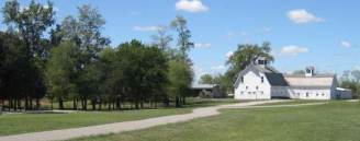
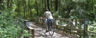
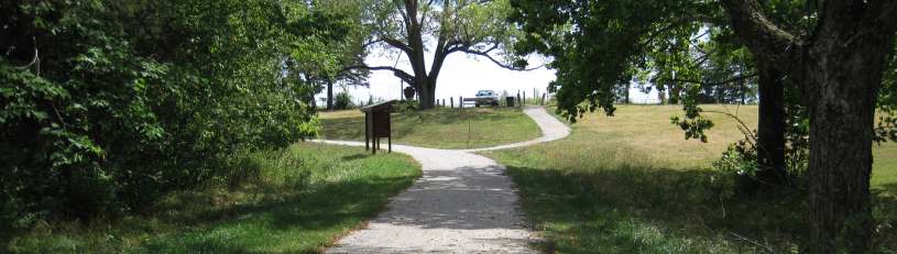
The Fairfield Loop Trail begins and ends at the Maasdam Barns. Photo by Werner Elmker.
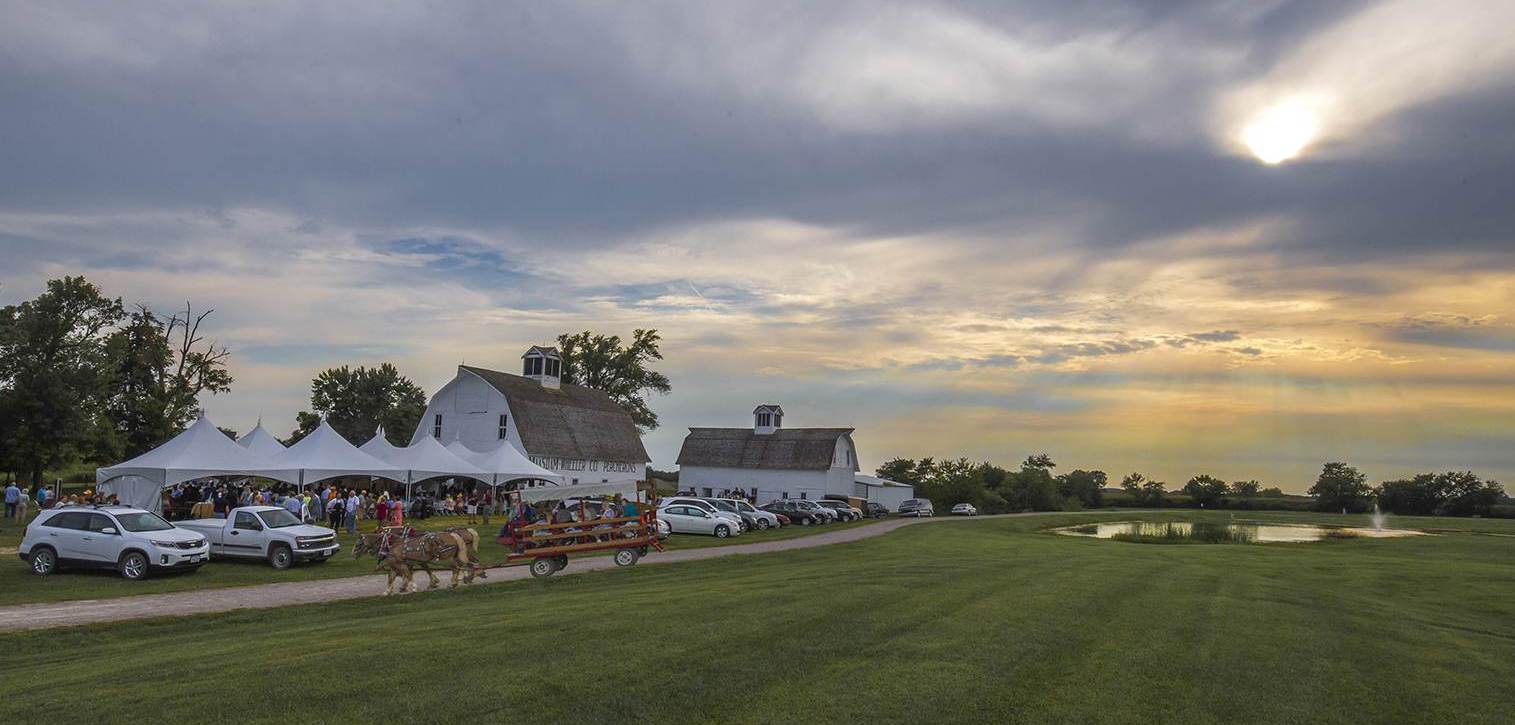
The Fairfield Loop Trail officially begins (and ends) next to the Maasdam Barns at Mile Marker Zero (Mile Markers occur every 1/4 mile along the Loop Trail). The Maasdam Barns are next to the Jefferson County Health Center, at the interchange of Hwy 1 & US 34.
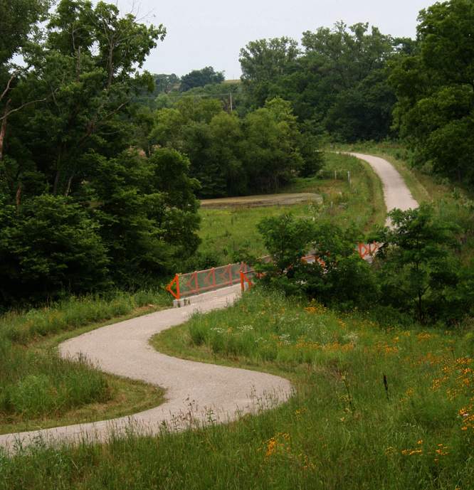
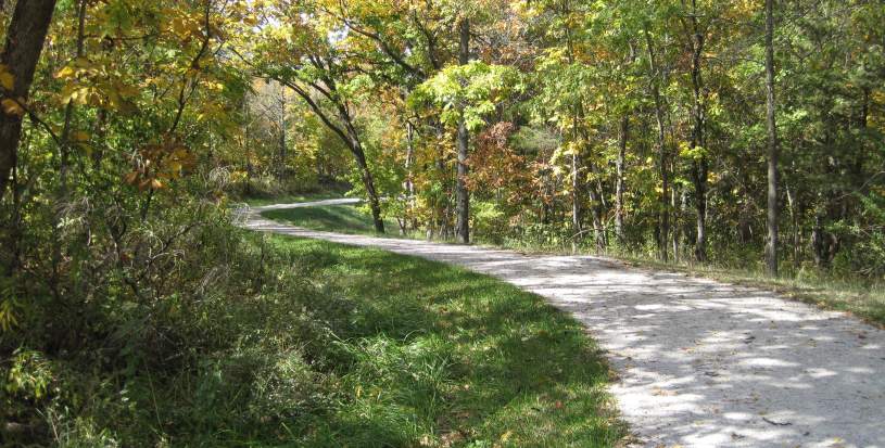
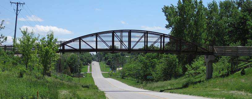
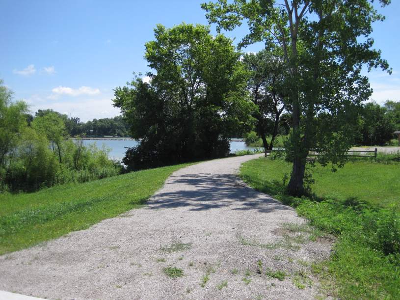
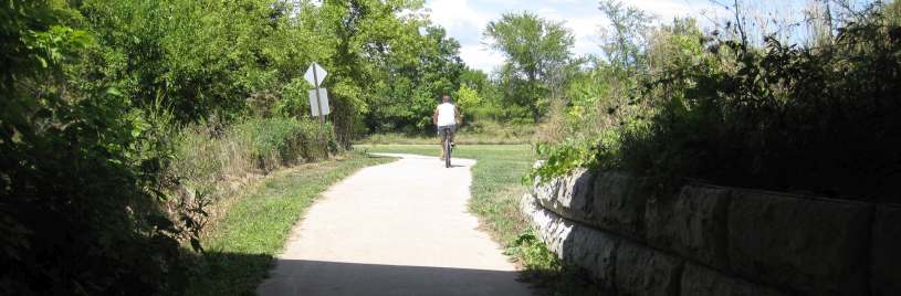
This 5.7-mile segment, Iowa DOT-South segment, built by the Iowa DOT, parallels the new US Hwy 34 bypass from Mint Blvd in the east to Whitham Woods in the west. It is hilly, with curves and woods, and passes by wetlands. It intersects with the Cedar View Trail, which leads to Jefferson County Park and Libertyville.
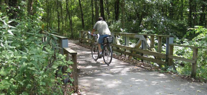
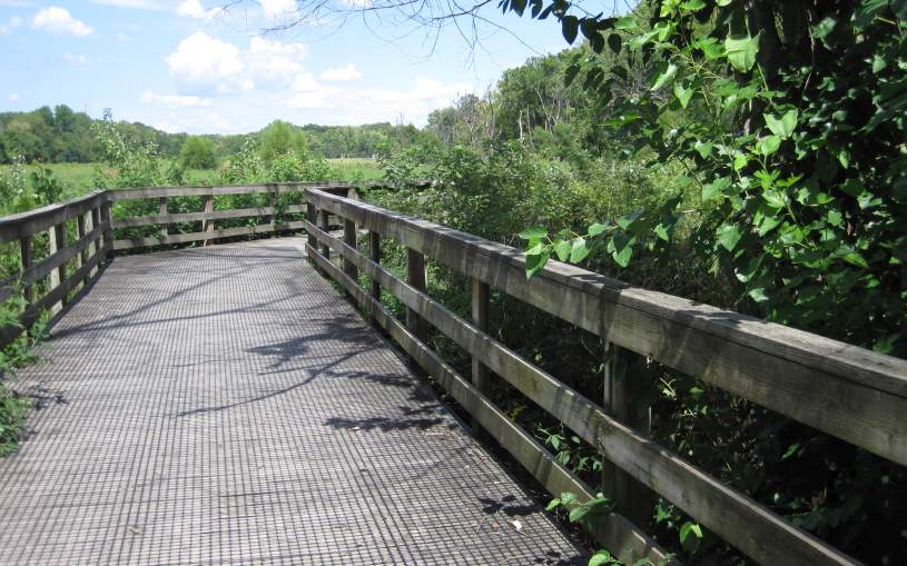
Below: One of Judy Bales "Nuts and Bolts" art-enhanced bridges on the South segment (see her website here. Photo by Judy Bales.
Facts about the Iowa DOT-South segment of the Loop Trail:
Length= 5.7 miles
Surface= Crushed limestone.
These are the only entry points to this segment -
East Entry= South Mint Blvd (south of Lamson Woods).
Hwy 1= Intersects with State Hwy 1 (South Main St) near the Jefferson County Health Center and Maasdam Barns.
Kale Blvd= Kale Blvd is south of Libertyville Rd.
Cedar View Trail= The Cedar View Trail connects to 32nd Street and Jefferson County Park.
West Entry= Connects with the Whitham Woods segment trail, near Whitham Woods.
Restrooms: At the Maasdam Barns Museum, and at the Cedar View Trail intersection.
Parking is available at the Maasdam Barns, at Kale Blvd, at the Cedar View Trail, and at Whitham Woods.
Connecting Trail: On October 5, 2013, a new 0.9-mile trail was dedicated by the Jefferson County Health Center. It uses the Loop Trail to make a complete loop around the Health Center, for use by walkers, runners, and bike riders. You may park in the Health Center parking lots.
Nearby Parks:
Jefferson County Park can be entered by using the trail that connects to the Cedar View Trail. See details at the Jefferson County Park webpage.
O. B. Nelson Park is about 0.5 mile away - take Hwy 1 north Details at the O. B. Nelson photo essay.
Some trail construction details
The trail was surfaced with fine limestone chips, as on other parts of the Loop Trail. Before that, however, you must have a stable base. First the ground is dug out to a six-inch depth, then base rock is placed on the ground. The irregularly shaped stones interlock with each other, providing a surface for the final layer of fine stones (lime chips in this case).
Some of the ground under the trail had never been disturbed before, so is soft, and perhaps wet. Therefore it takes time for the stones to settle down, so take care.
Aug 22, 2009 -- Iowa DOT Trail Inauguration
The inauguration took place on Sat, Aug 22, 2009. Health & Wellness for the community was the theme. This 6.5 mile-long section of the Loop Trail was built by Iowa DOT in conjunction with the bypass.
The trail is surfaced with limey chip. Trail access is provided only at the south end of Mint Blvd, on either side of Highway 1, at Kale Blvd (just south of Libertyville Drive), from the Cedar View Trail west of 32nd Street, or at the connection to the Whitham Woods segment just west of Whitham Woods.
Learn more about the Maasdam Barns on their website.

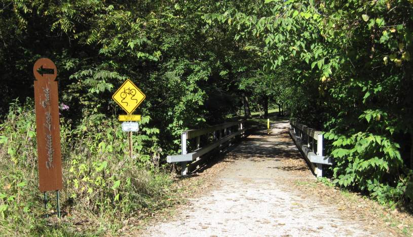
Whitham Woods segment (Segment # 2)
The Whitham Woods segment of the Loop Trail uses part of an old 1858-1901 railroad bed, then travels up and down hills through the woods, and then follows a concrete section along Burlington Ave to Brookville Road. (See aerial views here).
See more information on the Jefferson County Conservation Board website
Also, there is a new Self-Guided Interpretive Trail in Whitham Woods.
Below: The trail section within Whitham Woods was upgraded and rebuilt in September 2010.
Facts about the Whitham Woods segment of the Loop Trail:
Length= 1.2 miles.
Surface= Lime chips; concrete along Burlington Ave.
Western end= Connects with the western end of the DOT-South segment, just southwest of Whitham Woods.
Eastern End= The trail bridge at Brookville Road & Burlington Ave (connects to Northwest segment).
Restroom: At the Whitham Woods parking lot.
Parking: Whitham Woods parking lot.
Click to see Whitham Woods & trail construction, and Whitham Pond Update
Northwest segment (Segment # 3)
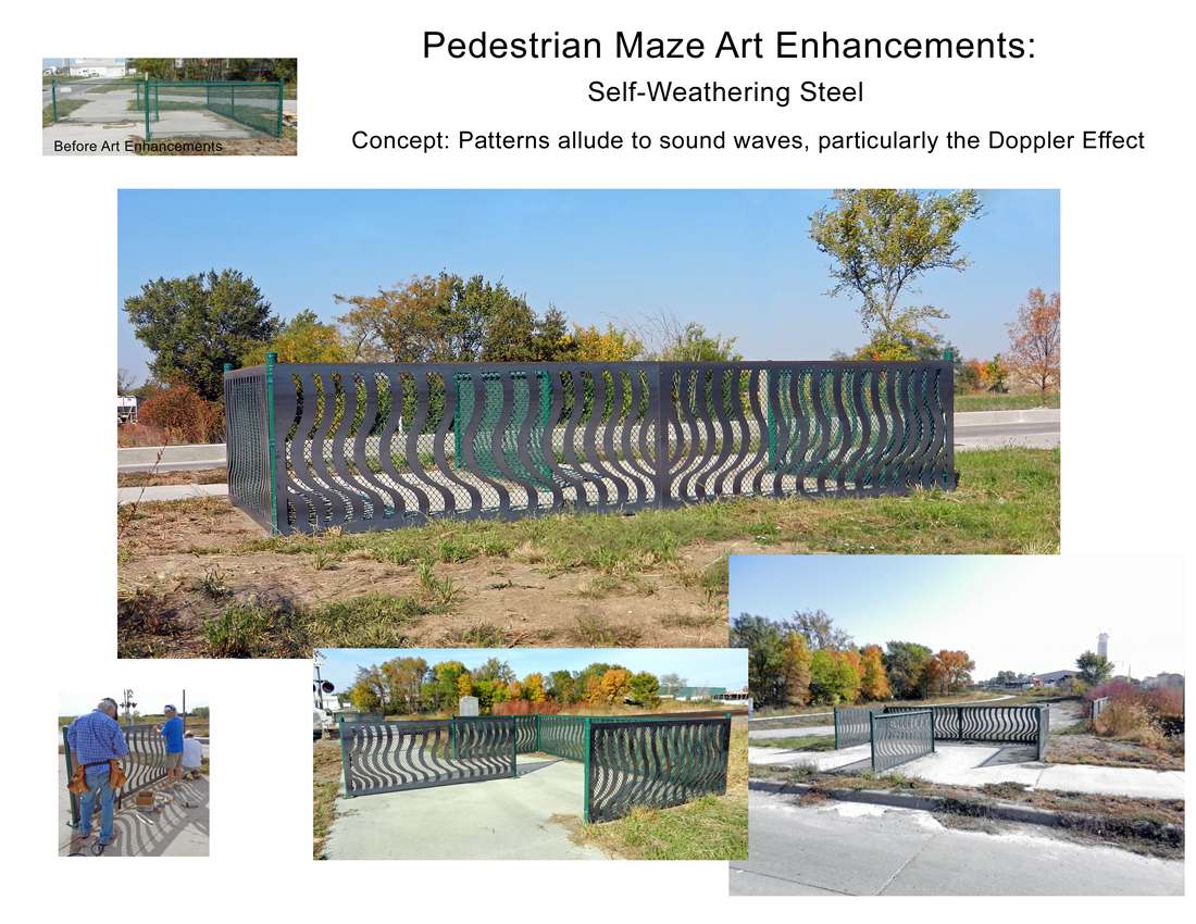
Most of the 2.2-mile surface of the Northwest segment is concrete. From Whitham Woods, it travels northeasterly from Brookville Road, crosses the BNSF railroad track through a pedestrian maze (for safety) and continues to the Rock Island Railroad segment at 8th Street. (See aerial views here).
Facts about the Northwest segment of the Loop Trail:
Length= 2.2 miles.
Surface= Mostly concrete, some lime chips.
Western end= Brookville Road, at Burlington Ave (connects to Whitham Woods segment).
Eastern end= 8th Street and Gear Ave (connects to Rock Island Railroad segment).
Restroom: At the Dexter Apache Soccer Park on Grimes Ave.
Nearby Parks:
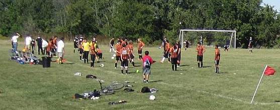
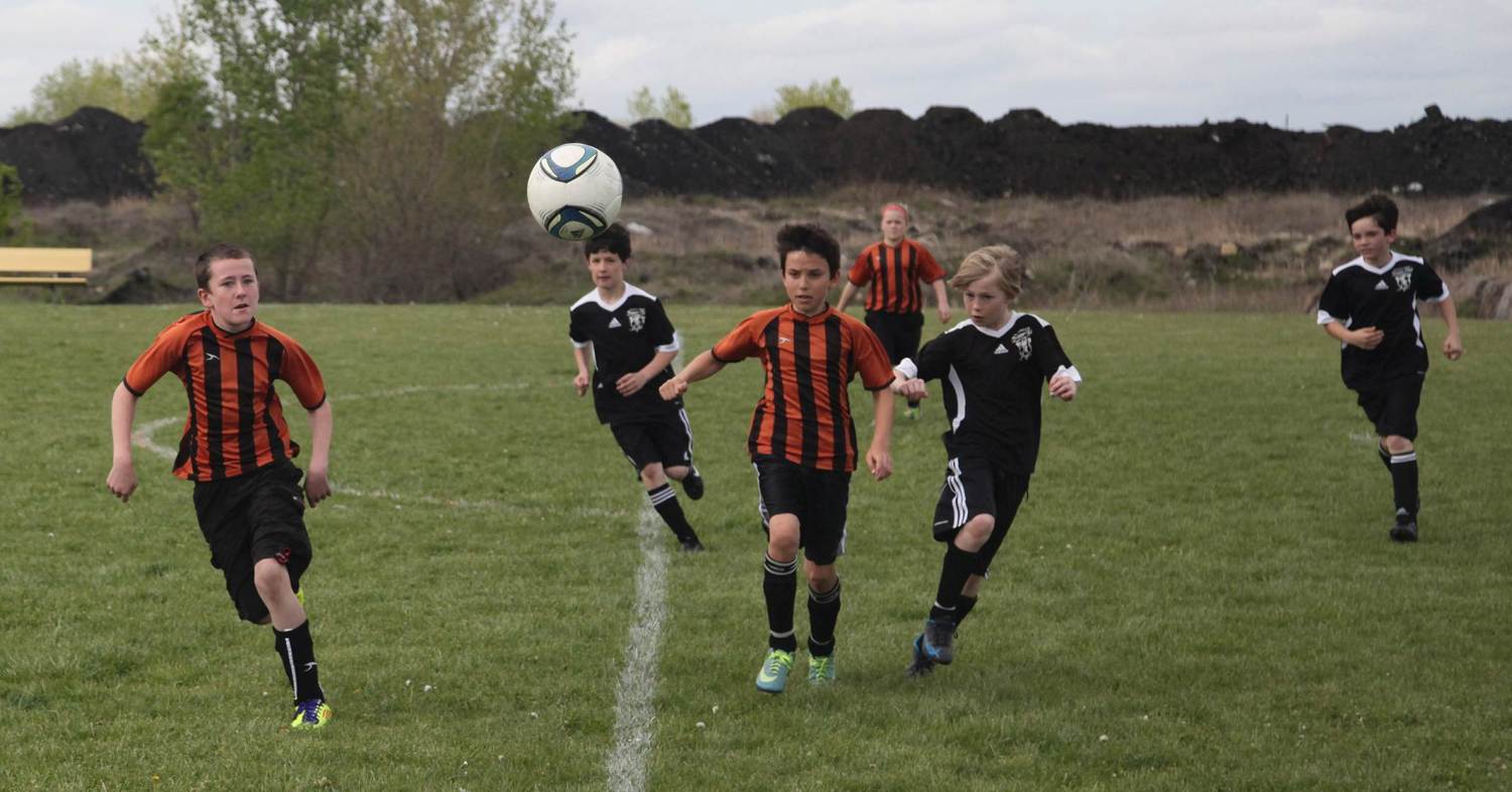
Dexter Apache Soccer Park is at 2519 Grimes Ave, on the Loop Trail (photo below).
Heritage Park is just south of Gear Ave, on North 9th Street. Photos here.
Below: Dexter Apache Soccer Park, next to the Fairfield Loop Trail/. Photo by Werner Elmker..
Below: Completed Loop Trail BNSF Railroad Crossing - design enhanced by Judy Bales.
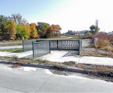
Below: Proposal for the enhancement to the BNSF RR crossing, to provide a safer crossing for the Loop Trail.
Rock Island Railroad segment (Segment # 4)
The Rock Island Railroad segment uses the roadbed of the Rock Island Railroad, which was in use from 1945 to 1980 (replacing a 1871 alignment). Our trail bridge replaces the railroad bridge, which was removed in 1985. (See aerial views here).
Facts about Rock Island Railroad segment of the Loop Trail:
Length= 1.3 miles - Uses old railroad roadbed.
Surface= Crushed limestone.
West Entry= Corner of 8th Street & Gear Avenue (connects to Northwest segment).
East Entry= North B Street (connects to B Street segment).
Parking: Marked Trail Parking Lot east side of the Matkin Bridge. Note - There is no parking lot on the west side of the Matkin Bridge.
Photo essays:
Travel the trail via a photo essay.
The Matkin Bridge story told with photos.
The Matkin Plaza story told with photos.
Nearby Parks:
Heritage Park is a block from the western end of the Railroad Trail. Details here.
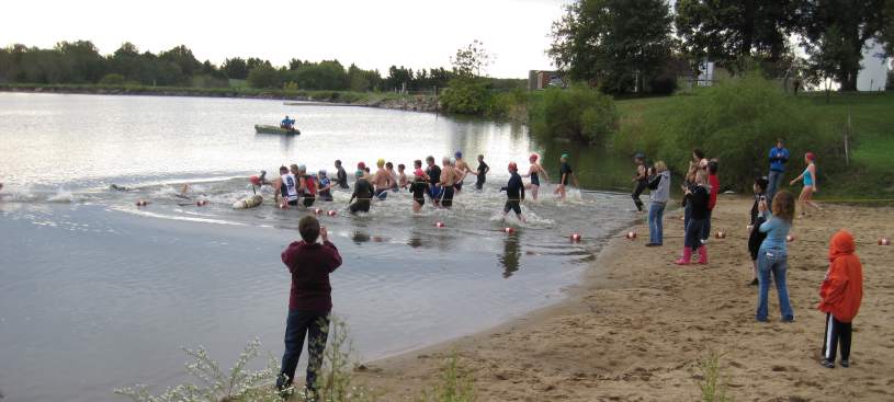
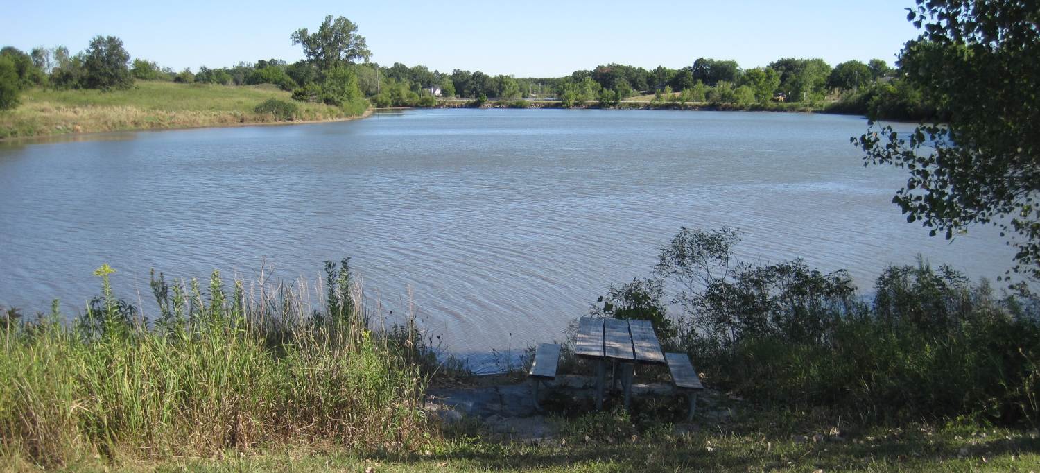
Waterworks Park main entrance is south of the Loop Trail on B Street. Bonnifield Lake has a beach for swimming. Details here.
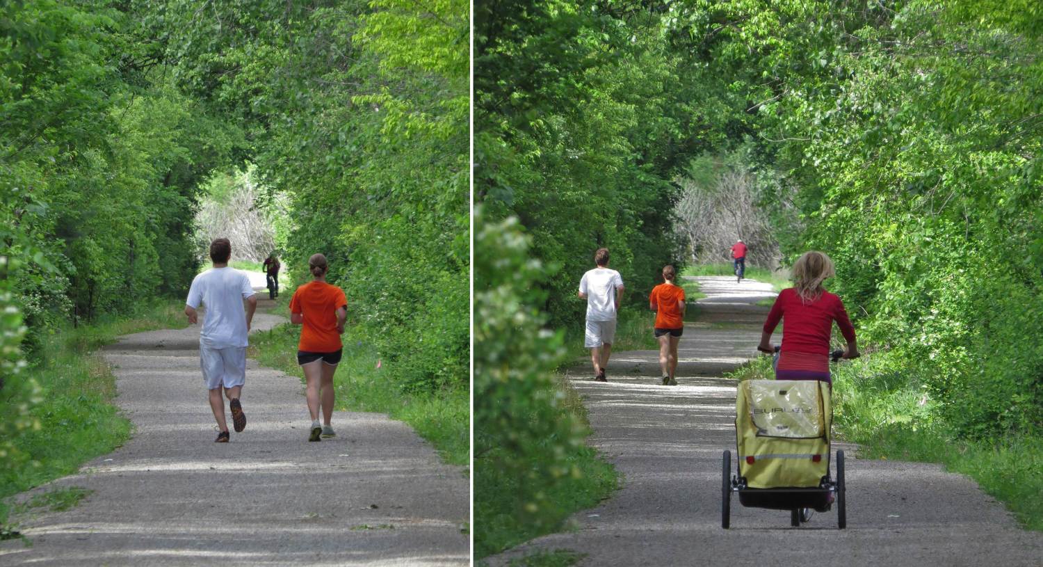
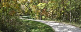
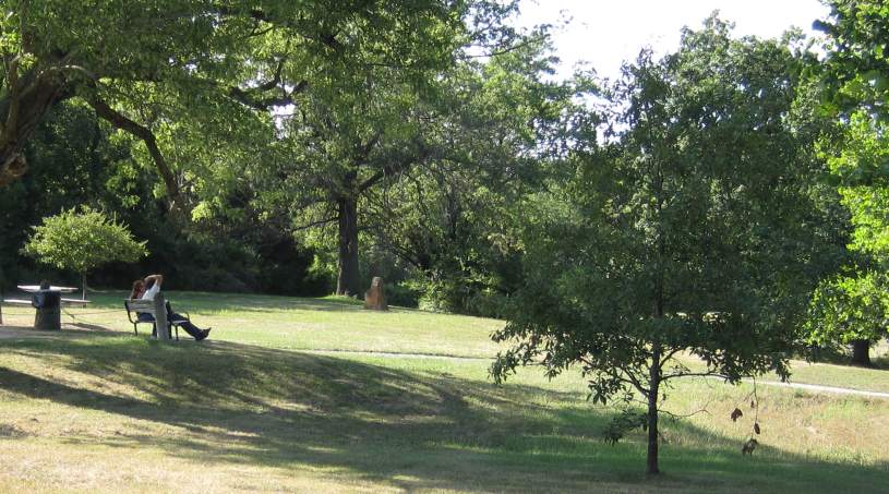
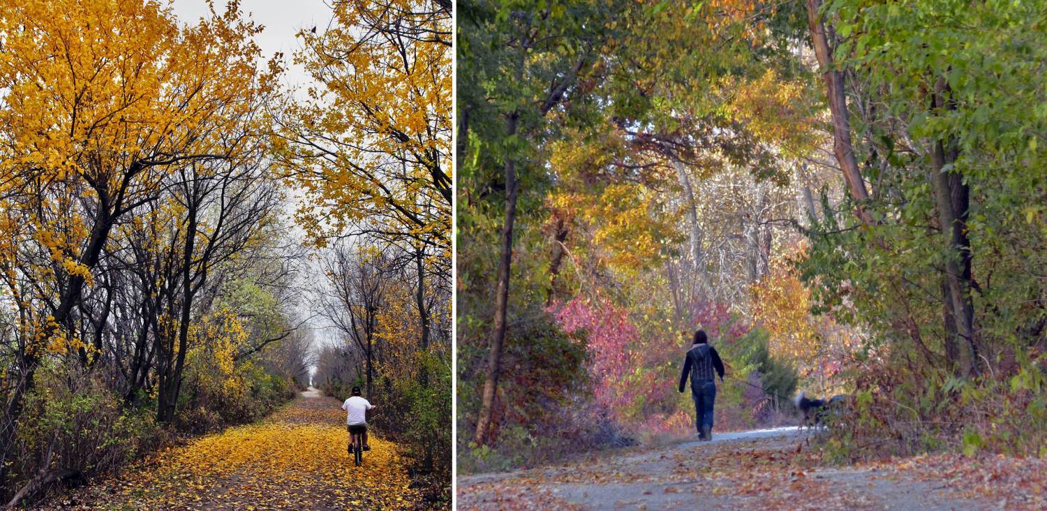
Below: More trail users on the Loop Trail, in the fall. Photos by Werner Elmker.
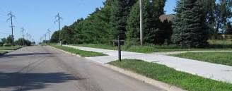
B Street segment (Segment # 5)
The B Street segment travels along B Street on a concrete-surfaced sidewalk for 4/10ths of a mile to connect to the Lakes segment. Note that the sidewalk continues southward to Waterworks Park and Stone Ave.
Below: B Street, looking south from the connection to the Rock Island RR segment.
Parking: North B St at Zimmerman Blvd.
Facts about the B Street segment of the Loop Trail
Length= 0.4 miles
Surface= Concrete (sidewalk).
North Entry= North B Street (connects to Rock Island Railroad segment).
South Entry= North B St at Zimmerman Blvd (connects to Lakes segment). Zimmerman Blvd is an entrance to MUM.
Nearby Parks:
Waterworks Park main entrance is south of the Loop Trail on B Street. Bonnifield Lake has a beach for swimming. Details here.
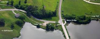
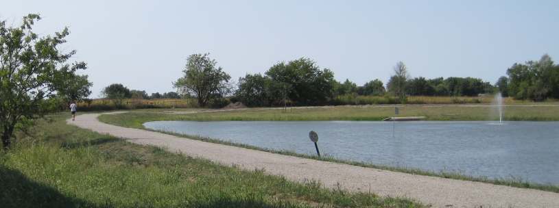
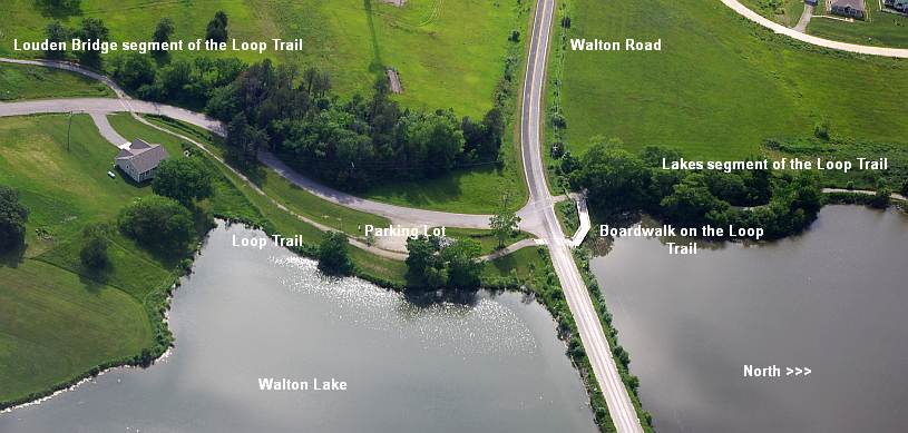
Lakes segment (Segment # 6)
Below: This map shows the three lakes, this Loop Trail segment, and the three walking-only trails. (See more aerial views here)
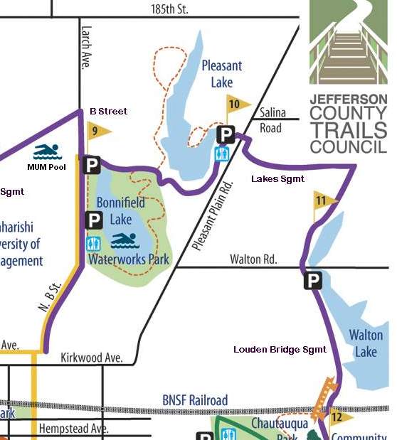
The Lakes segment connects three lakes - Bonnifield Lake, Pleasant Lake, and Walton Lake. The trail meanders along fields and through wooded areas. These three lakes are retired reservoirs, converted to recreational usage. There is a Native Prairie along the Loop Trail - see the Kiosk.
Facts about Lakes segment of the Loop Trail:
Length= 2.25 miles (Bonnifield Lake to Pleasant Lake to Walton Lake)
Surface= Crushed limestone.
West Entry= North B St (connects to B Street segment at Zimmerman Blvd).
Pleasant Lake Entry= Pleasant Plain Rd.
South Entry= Walton Rd, near Walton Lake (connects to BNSF segment).
Restroom: At the Pleasant Lake parking lot.
Parking: B St parking lot, Pleasant Lake parking lot, Walton Road parking lot, and in Waterworks Park.
Below: Bonnifield Lake is in Waterworks Park. The main entrance is just south of the Loop Trail on B Street. There is a beach for swimming, and a trail around the lake. See the Kiosk. Or walk between Bonnifield Lake and Pleasant Lake via the From Pleasant Lake to Bonnifield Lake photo essay.
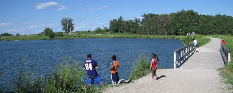
Below: Pleasant Lake allows fishing and non-motorized boats, and walking-only trails encircle part of the lake. Photos of Lake-to-Lake trails
Below: Walton Lake hosts the Walton Country Club and the golf course, and some private residences
Below: Walking-only trails are around Bonnifield Lake and are on the east and east sides of Pleasant Lake. (More details here.)
Reservoirs to Recreation - Fairfield City Lakes
The City of Fairfield and the Park & Recreation department are transforming the three city water reservoirs into water recreation areas, since the reservoirs were set aside as emergency sources of city water in 2005. Please have respect for the lakes and help keep them clean. See the Lakes History Kiosk for more.
Fishing in the Lakes
The Iowa DNR has been updating its renovation and rehabilitation plan for the three city lakes in consultation with the Fairfield Water Department and the Fairfield Park and Rec Department. Details on the Fishing Kiosk.
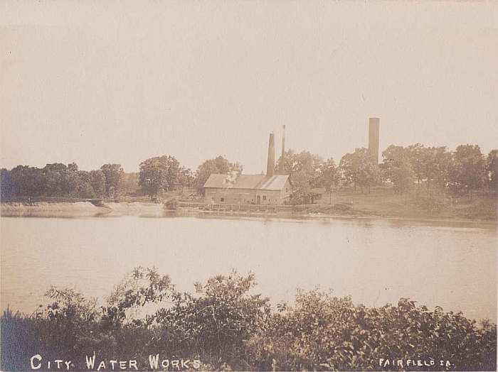
Below: Fairfield Water Works, reservoir # 1, from a 1906 postcard, thanks to Gene Luedtke
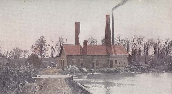
Below: Another postcard - the dam is to the left. Thanks to Gene Luedtke
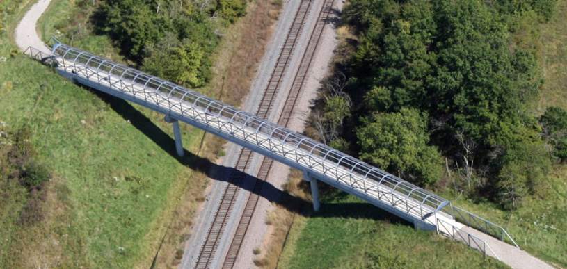
Louden Bridge segment (Segment # 7)
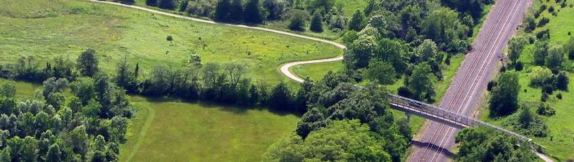
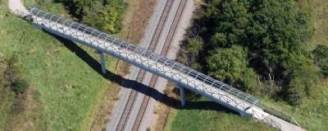
The Louden Bridge segment travels through woods, then crosses the BNSF Railroad tracks on the 246-foot Louden Bridge to connect with Chautauqua Park, where it meets the Crow Creek segment. (See more aerial views here).
The bridge displays 171 ceramic plaques of images from Louden blueprints, made by a Fairfield High School art class.
Historical Note: The "back-side" of the park's loop road and the Huggins Family Bridge section uses the abandoned railroad roadbed of the first railroad into Fairfield (1858), the Burlington and Missouri River Railroad (now the BNSF). See the Railroad History kiosk
Below: Louden Bridge over the BNSF Railroad mainline. (See more Judy Bales photos here).
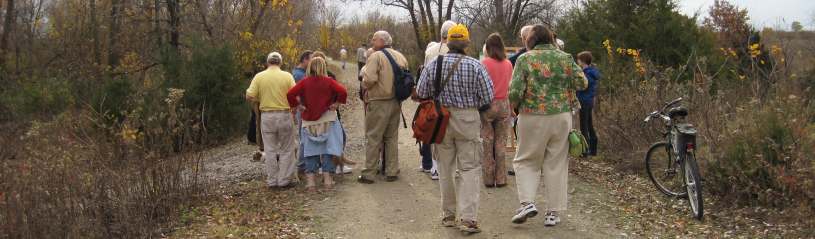
See a photo essay of this trail segment with Chris.
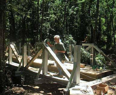
See the building of, and info about, the Louden Bridge over the BNSF Railroad.
Look at Judy Bales pages about community involvement and public art designs.
Look at the Kiosk Panel about the Jack Eastman Wetlands.
Facts about the Louden Bridge segment of the Loop Trail:
Length= 1 mile.
Surface= Crushed limestone.
North Entry= Walton Road, at Walton Lake Drive (connects to Lakes segment).
South Entry= The Huggins Family Bridge at the east end of Chautauqua Park (connects to the Crow Creek segment, which follows Crow Creek).
Restroom: In Chautauqua Park, western end.
Parking at Walton Rd lot, and in Chautauqua Park.
A Walking Trail was created in the new wetlands area in April 2012 (see details under Community orchard & wetlands, below).
Nearby Parks:
Chautauqua Park connects to the Loop Trail via the Huggins Bridge. Photo essay.
Community orchard & wetlands, south of the Louden Bridge (includes walking-only trail). Photo essay.
Fairfield Little Ruth League is on Glasgow Road, at East Burlington Ave. Photos here.
Central Park is 3/4 miles east of the Loop Trail on East Broadway Ave Photos here.
Howard Park is 2 blocks north of Central Park Photos here.
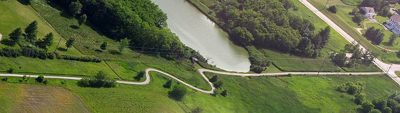
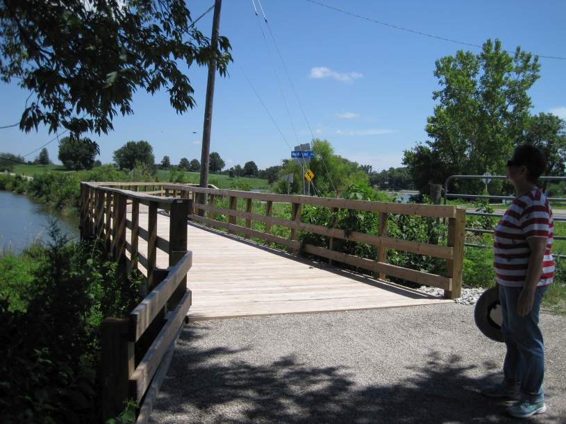
Below: The new boardwalk at Walton Road, at Walton Lake.
Below: Aerial view of the Loop Trail - the new boardwalk is just right of center.
Below: The northern end of the Louden Segment, heading towards Chautauqua Park.
Below: On the trail, at the north end of Bonnifield Lake. Photo by Werner Elmker.
Below: Walking-only trail east of Chautauqua Park in the Community orchard & wetlands (established in 2012).
Below: Huggins Bridge over Crow Creek into Chautauqua Park. Or go left to the Crow Creek segment.
Crow Creek segment (Segment # 8)
The Crow Creek segment follows Crow Creek from Chautauqua Park to Glasgow Road. The northern part is concrete-surfaced, leading to the crushed limestone surface in a wooded low-land, where three bridges cross creeks in the Fry property. Cross Glasgow Road to enter Lamson Woods/Neff segment of the Loop Trail.
Length= 0.6 miles.
Surface=Crushed limestone; concrete at the northern end.
North Entry= The Huggins Family Bridge in Chautauqua Park (connects to BNSF segment).
South Entry= The intersection of Glasgow Rd and Middle Glasgow Rd (connects to Lamson Woods/Neff segment).
Restroom: In Chautauqua Park, western end.
Parking is available in Chautauqua Park, and there is a small parking lot on Middle Glasgow Rd.
Nearby Parks:
Chautauqua Park connects to the Loop Trail via the Huggins Bridge. Photo essay.
Fairfield Little Ruth League is on Glasgow Road, at East Burlington Ave. Photos here.
Below: One of three bridges volunteers built on the Crow Creek segment.
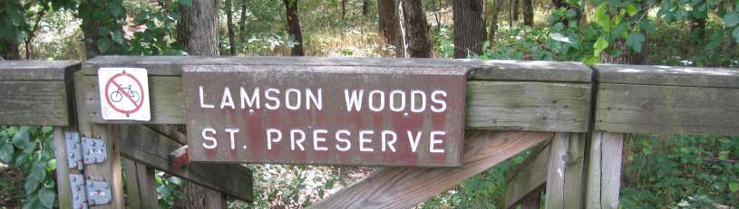
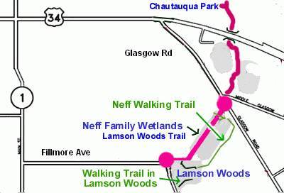
Lamson Woods/Neff Wetlands segment (Segment # 9)
The Lamson Woods/Neff Wetlands section of the Loop Trail begins at Glasgow Road and heads west across the wetlands dike. The Lamson Woods boardwalk/bridge takes you to the Mint Blvd parking lot. A walking-only trail is accessed from the boardwalk. Lamson Woods is a State Preserve (scroll down for details). NOTE: The Neff Wetland section was donated in May of 2017 by Dave and Sherri Neff to the Jefferson County Conservation Board. The area will be used for environmental purposes by the JCCB. More details on the Neff Wetland section of the JCCB website.
Facts about the Lamson Woods/Neff segment of the Loop Trail: See photos of the Lamson Woods/Neff segment.
See the kiosk describing the Iowa DOT wetlands restoration project.
Length= 0.4 miles
Surface= The 326-foot Zillman Bridge/boardwalk has a wooden deck. The rest is crushed limestone.
East Entry= on Glasgow Rd, 0.6 miles south of Hwy 34, at Middle Glasgow Rd (connects to Crow Creek segment).
West Entry= Intersection of E. Fillmore Ave and Mint Blvd (connects to Mint Blvd Link).
Restroom: At Lamson Woods parking lot, off Mint Blvd.
Parking at the Lamson Woods parking lot, off Mint Blvd and E. Fillmore Ave.
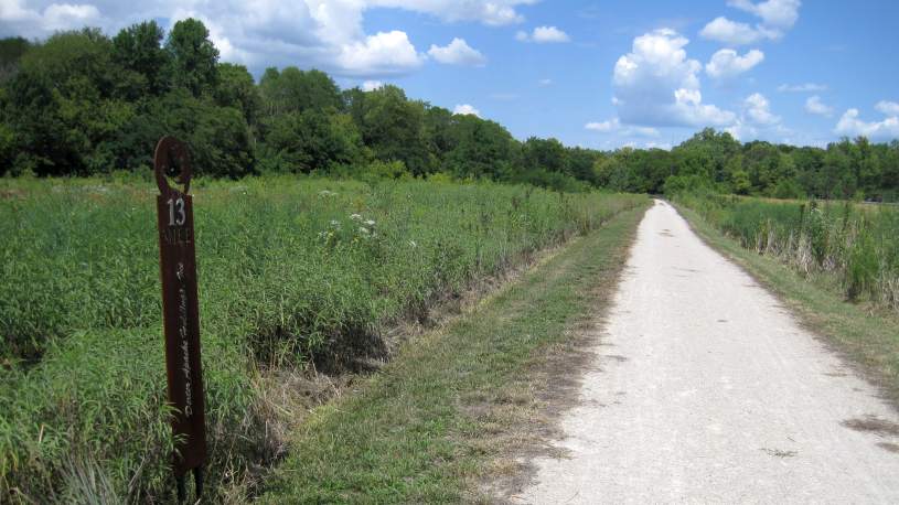
Below: Mile 13 on the Loop Trail through the Neff Wetlands.
Below: East entrance onto the Neff Wetlands trail. See photos of the bridge
 .
.
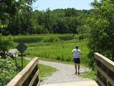
Below: Looking from the Mint Blvd parking lot to the West entrance onto the Lamson Woods Trail.
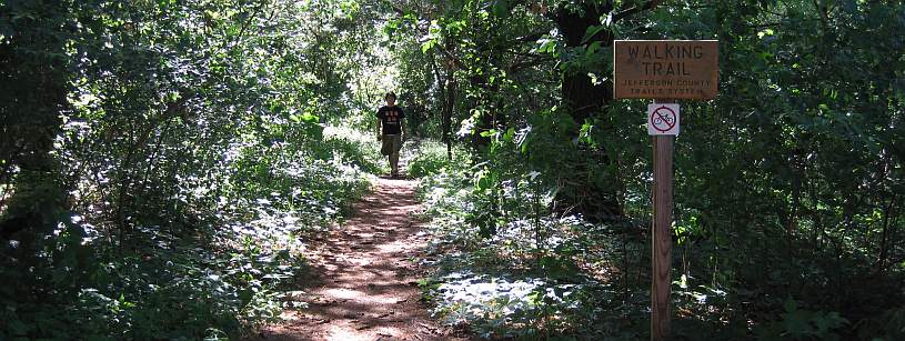
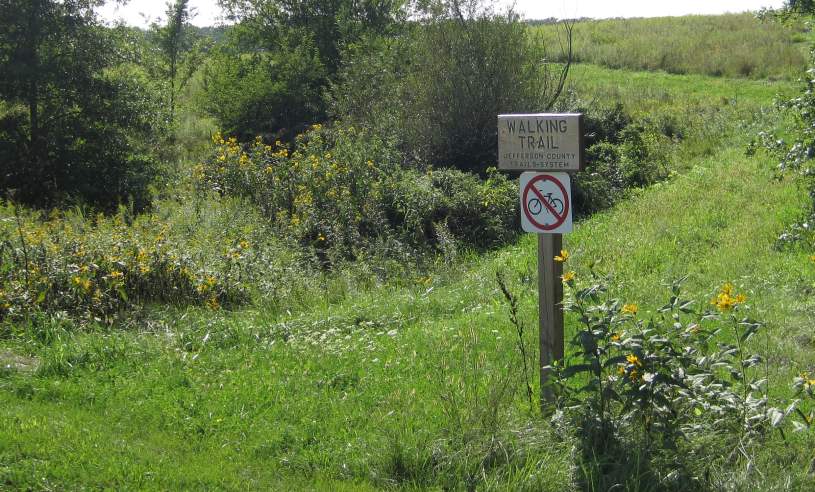
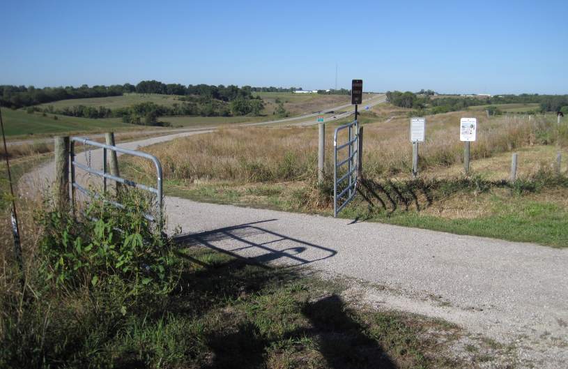
Walking Trails: The walking-only trails are for walking only. The trail in Lamson Woods is in a State Preserve - please obey all of the rules.
The Neff Walking Trail loops from the Loop Trail to the Lamson Woods Walking Trail.
Walking-Only trails map:
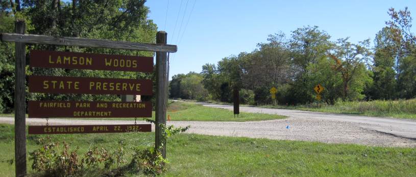
About Lamson Woods State Preserve
Text from the kiosk - see Lamson Woods kiosk here.
Lamson Woods is a 43-acre woodland preserve located on the southeast edge of Fairfield. This hilly, wooded area was willed to the city of Fairfield by Carrie Lamson Ross in 18930. Originally "Lamson's Pasture" was a park that included Fairfield's first golf course. The golf course was in a pasture for cows and pigs along a small woodland, and was dubbed "cow-pasture golf". It was a favorite area for hiking and nature study for people of all ages. The woodland was dedicated as a biological state preserve in 1978.
The preserve is a mixture of upland and lowland forest. Mesic and dry woodland species occupy the slope and ravines that are cut into Pre-Illinoian glacial deposits (500,000 to 2.5 million years old) typical of the Southern Iowa Drift Plain landform region. Trees occupying the canopy include cottonwood, white oak, bur oak, shingle oak, shagbark hickory, American elm, hackberry, and black cherry. Ohio buckeye can be found in the understory with hazelnut along the woodland edges. A planted pine grove is located in the southwest corner of the preserve.
The spring wildflower display begins with the blooming of bloodroot, bluebells, and spring beauty, followed by prairie trillium, tooth wort, white trout-lily, blue phlox, wild geranium, mayapple, Solomon's seal, swamp buttercup, and wild hyacinth. By May, moonseed and Jacob's ladder can be seen in flower followed by jumpseed and pale touch-me-not in July. August brings the blooming of hog peanut among the sensitive dren and maidenhair fern fronds. In the fall, the bright red leaves of Virginia creeper can be seen crawling up the trunks of trees or along the ground.
(From The Guide to Iowa's State Preserves).
See a topo map here.
To learn more about the Iowa DNR State Preserves program, go to the Iowa DNR website.
Mint Blvd Link (Segment # 10)
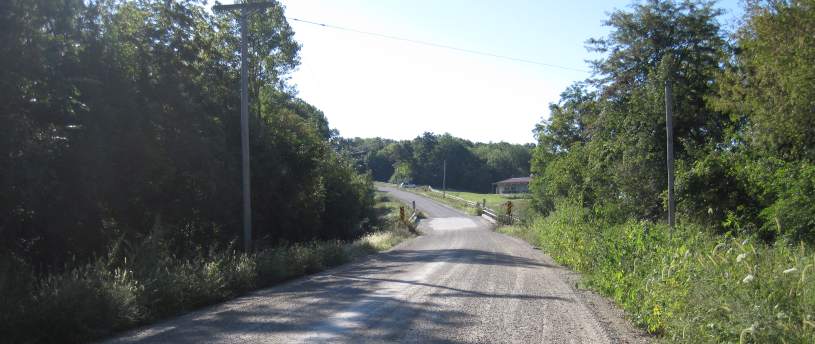
Mint Blvd is used by the Loop Trail (as a shared roadway) to connect the Lamson Woods/Neff wetlands segment to the DOT-South segment. Part of Mint Blvd is steep, with a gravel surface. Improvements are being discussed.
Facts about the Mint Blvd Link, part of the Loop Trail:
Length= 0.8-mile shared roadway, with no outlet at the southern end for vehicles.
Surface= Gravel road. Condition varies.
North Entry= Mint Blvd at E. Fillmore Ave (connects to Lamson Woods-Neff segment).
South Entry= Mint Blvd ends at the connection with the east end of the DOT-South segment.
Restroom: At Lamson Woods parking lot, off Mint Blvd.
Parking available at Lamson Woods parking lot.
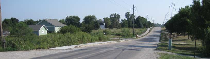
Below: Looking south, Mint Blvd crossing over Crow Creek.
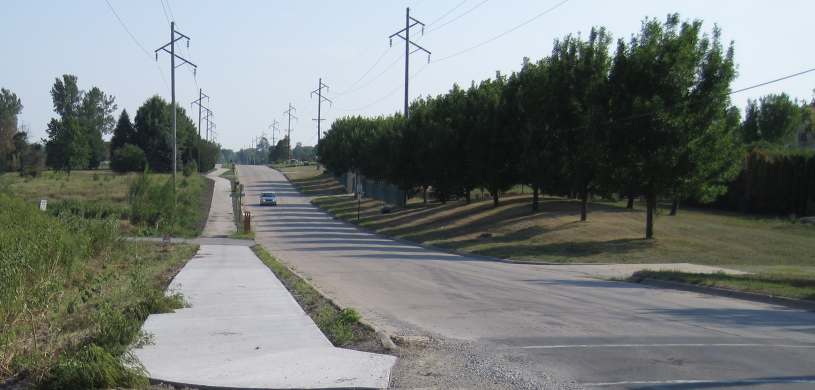
Below: Southern end of Mint Blvd, connecting to the DOT-South segment, with the freeway to the left.
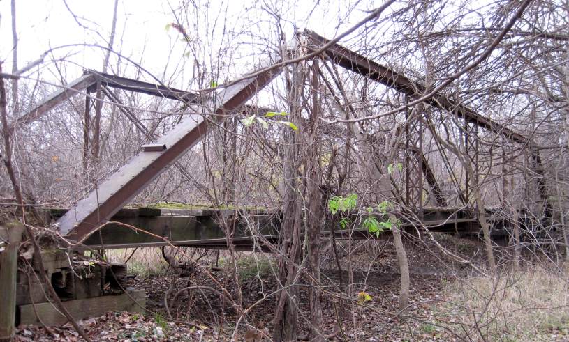
Below: Abandoned bridge along Mint Blvd.
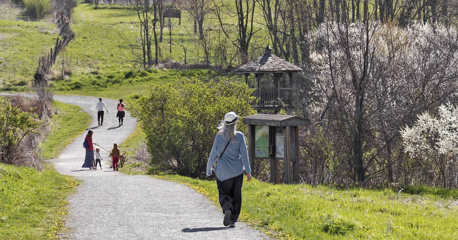
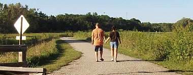
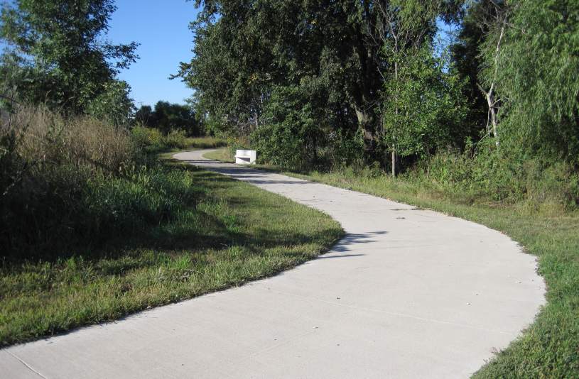
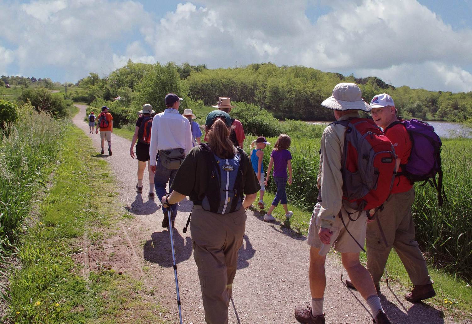
Below: Walkers and riders somewhere on the Loop Trail. Photos by Werner Elmker.